As California’s population grows, so will its demand for a full range of infrastructure and services. An efficient transportation system, for example, is crucial for the state’s economy and people. So is a system for storing water and moving it to where it’s needed.
Water is a perennial problem in California, but it is not the problem most people think it is. Viewed strictly as a matter of quantity, California does not have a water shortage, nor will it anytime soon. The state’s water is plentiful, but it is inconvenient for human use; distributed unevenly across time and space, it is rarely where we want it when we want it. About three quarters of the potential water supply in the state of California originates north of the city of Sacramento, while about three quarters of the demand is south of the city. During flood times, the state’s most pressing water problem is getting rid of it, while in dry times the problem lies in storing and moving it.
 Traditionally, governments have resolved this mismatch between the location and timing of supply and demand by building dams and canals—or “storage and conveyance” in the water planning lexicon. Today these are only two among many tools in California’s water supply and flood control infrastructure—its “waterscape.” However, our approaches to water management strategies must evolve substantially in the future. California’s population continues to grow; the state’s Department of Finance projects that in 2030 California will have twelve million more people than today. Also, intense development of California’s water resources has already exacted a huge cost to the state’s natural environment. Dam construction has inundated hundreds of valleys, populations of salmon and many other fish are a small fraction of what they once were, and water quality has suffered from industrialized agriculture and urbanization. Climate change promises to complicate matters still further. California must diversify its water management strategies and place a premium on consumption efficiency and management flexibility.
California Water Use In Context
Despite a widespread perception to the contrary, California is blessed with substantial annual precipitation in most years. The annual average rainfall in Sonoma County, which is far from the wettest part of the state, is about the same as central Indiana—yet we do not think of Indiana as dry, and indeed Indiana has a long history of non-irrigated agriculture. California differs from Indiana in the pronounced seasonality of its precipitation, its long summer drought, and its greater year-to-year variability in precipitation. The state also has large variations in the amount of precipitation that falls in the north and south, and at high elevations and low.
It’s also important to recognize that water is water. We tend to think of flood control and water supply as different problems that require different organizations and planning approaches. We also tend to think of groundwater and surface water as different resources, and we adjudicate them in different ways. But in fact floods, droughts, surface flows, and groundwater aquifers are all part of the same hydrological cycle, and our institutions and infrastructure should reflect that.
FIGURE 1
Water supply and use in three recent
California water years
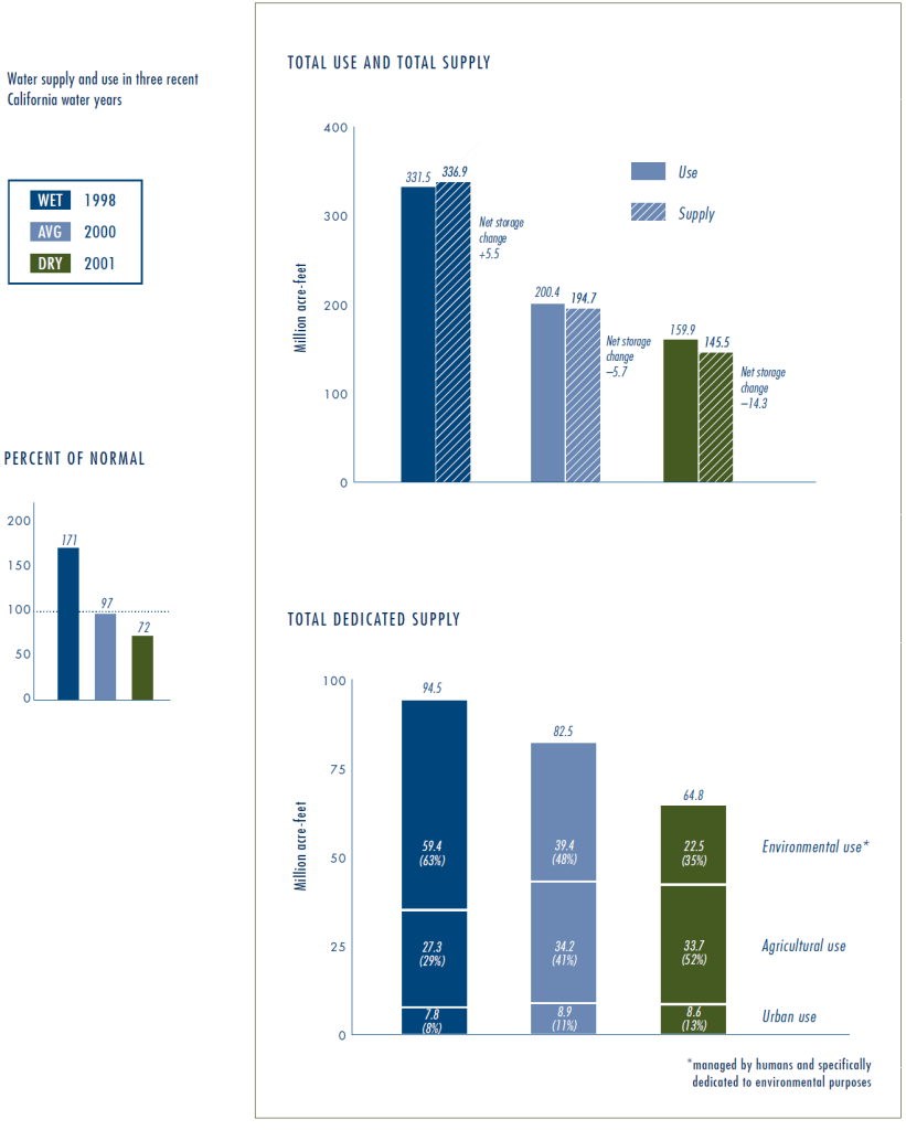 Data from three recent years (one wet, one average, one dry) in Figure 1, sketch the outlines of the water cycle in California. “Total use” includes large flows (such as rivers flowing to the ocean) that are not “used” by people in the normal sense of the word, whereas the “total dedicated supply” (the last graph) consists of the water that human institutions explicitly decide how to allocate. Perhaps unsurprisingly, the environmental portion of the dedicated supply (i.e. the water dedicated to maintaining environmental quality in rivers, lakes, and wetlands) varies much more than the relatively inflexible urban and agricultural uses. Because urban demands change little from year to year, and because agricultural demands are greater in dry years (when there is less “free” irrigation from rain falling directly on fields), those uses take up a much larger percentage of the pie in the dry years.
Any effort to address water management problems in California needs to carefully consider how to handle agricultural needs.
Much more water is used for agriculture than is used in urban areas. In the dry year of 2001, for example, agriculture used 34 million acre-feet (maf) of water, while urban uses accounted for 9 maf, a nearly four-to-one ratio. Even in the wet year of 1998, farms used well over three times as much water as urban areas. Any effort to address water management problems in California therefore needs to carefully consider how to handle agricultural needs.
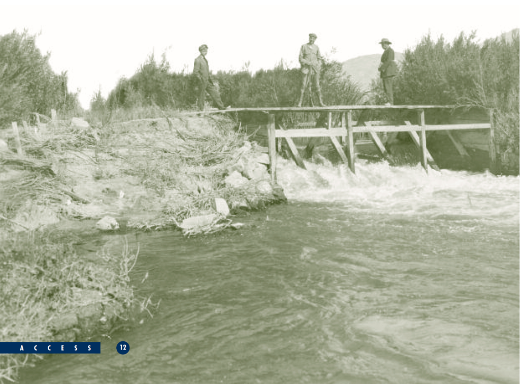
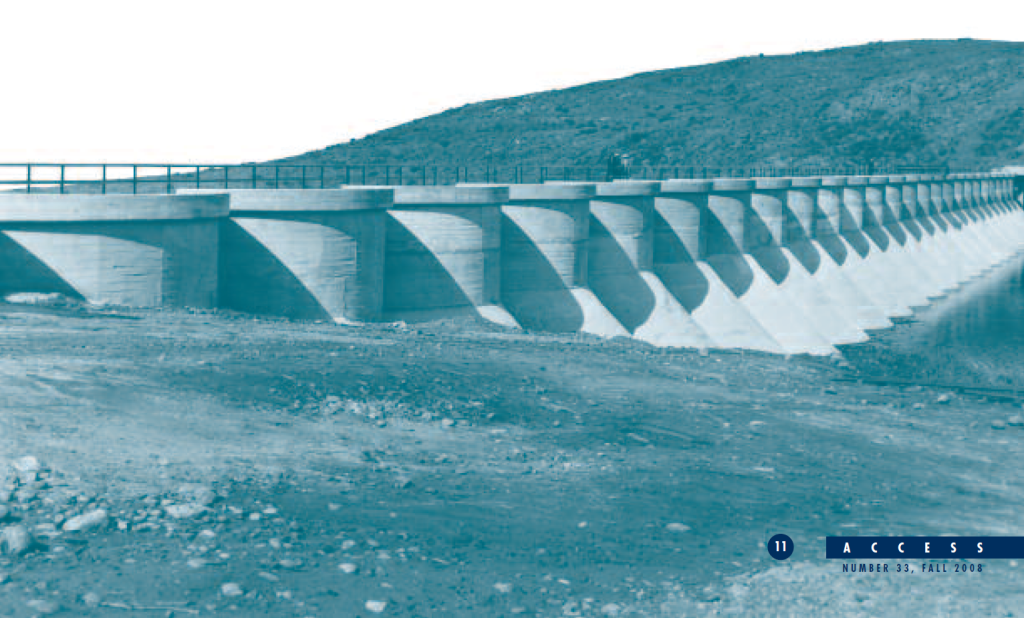
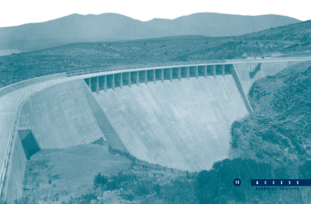
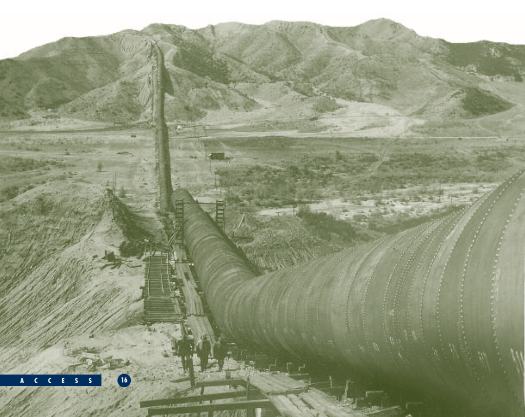
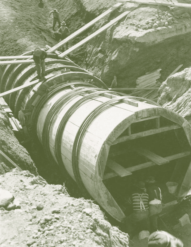 Surface and groundwater storage have historically been the backbone of the state’s water system, allowing managers and landowners to retain and access water at moments of their choosing. In a Mediterranean climate that is dry all summer, it could scarcely be otherwise. State, federal, and local agencies have made massive investments in surface storage throughout the state for decades, to the point that there are few practical and economical sites remaining to develop. But, as large as our reservoirs are, groundwater aquifers are still by far the largest potential storage areas. Indeed, groundwater banks may be the only place to find the quantities of storage that will likely be necessary to meet growing demand in the coming decades. To transport water from storage sites to point of use has required construction of a network of canals, some of which bring water west- ward from high elevations in the Sierra Nevada to urban centers along the coast, then move water southward to meet agricultural and urban demand. Much of this water transport crosses active faults, and some crosses the Sacramento Delta, a region that is extraordinarily vulnerable to disruption by earthquakes and flooding.
The Tenuous Situation of the Delta
The fate of the Sacramento-San Joaquin Delta (at the north end of which sits the city of Sacramento) looms large in the state’s water policy debates, because getting water from areas of origin to areas of use requires moving it from north to south, and that means somehow conveying water through the Delta. But the Delta is ecologically and geologically unstable, and because of that, the water supply for most Californians is unreliable.
The Delta is the hub of the two largest conveyance systems in the state, the State Water Project and the Central Valley Project, which together carry roughly one fourth of the state’s developed water supply from the Sacramento River system to the south. While political debates about Delta management have often focused on the quantity of water these systems export to southern California, the Bay Area is actually more dependent on the Delta than is urban southern California. Moreover, upstream diversions remove more water from the Delta system than do the two water projects. As a result, the environmental sustainability and supply reliability of the Delta require policies that directly affect most of the state’s residents, not just those in southern California or the San Joaquin Valley.
The Delta is particularly vulnerable to flooding—far more so than New Orleans or any other part of the United States.
The primary risk to the Delta is flooding. The Delta is not unique in this regard— the lower Sacramento and San Joaquin Valleys, for instance, are basically huge flood- plains. Earthquakes and wildfires capture the California imagination, but few people realize how dramatic and damaging Central Valley floods have been at numerous points in the state’s history. In 1997, for example, flooding on the San Joaquin River caused over $2 billion in damage. But the Delta is particularly vulnerable to flooding—far more so than New Orleans or any other part of the United States. The Delta has been spared a devastating inundation in recent decades because upstream reservoirs and flood bypasses have been sufficient to control the floods we have experienced, but there is no reason to think our luck will last forever.
In fact, the risk of a levee failure disaster in the Delta is extraordinarily high. Two members of the CalFed Independent Science Board estimate that there is a more than 66 percent chance of mass levee failure in the Delta before 2050, due to earthquake or flooding. Because most Delta “islands” are actually basins below sea level, a mass levee failure would result in a large intrusion of saltwater from Suisun Bay into the central Delta, potentially spoiling the freshwater supplies that millions of agricultural and urban users depend upon. Levee failure would also disrupt transportation and infrastructure corridors that cross the Delta.
 The rapid urbanization of the Delta’s edges exacerbates these flood threats and makes their long-term mitigation more difficult. This urbanization is driven, in part, by powerful perverse incentives that encourage people to move into harm’s way. Since the early 1970s, federal flood control policy has decreed that property owners living in a natural floodplain behind levees certified to provide 100-year flood protection need not obtain flood insurance. The clear implication of this policy is that the levees make these floodplains safe places to build. But many people misunderstand the risks they face. A 100-year flood protection levee does not guarantee protection for 100 years. Even if they are protected against a 100-year flood (with its one percent chance of occurring in any given year), they are not protected against the inevitable larger floods. A 200-year flood has a one-half percent chance of occurring in any given year, and a 500-year flood a one-fifth percent chance. When we add up these individual risks, we obtain a “residual risk” of being flooded by a greater-than-100-year flood: this is a 26 percent risk of levees being overtopped sometime during the life of a 30-year mortgage. Many property owners would consider that risk intolerable if they were fully aware of it. Residual risk remains surprisingly high—still well over ten percent—even for the 200-year levels of flood protection recently mandated for the Central Valley.
The risk of flooding will likely be exacerbated by climate change. Climate models generally predict that California will continue to receive the same amount of average annual precipitation, but that less of that precipitation will arrive as snow. Snowpack in the Sierras is immensely important to the state’s water system, since it is a form of storage, allowing water to be retained in the mountains, free of charge, until well into the spring. In addition, snow melts more gradually than rain runs off, so flood peaks are lower and management of the flows is easier.
The risk of flooding will likely be exacerbated by climate change.
The state predicts that climate change could reduce Sierra snowpack storage by as much as five million acre-feet. Once this occurs, flood peaks in Central Valley rivers will be higher and more frequent, placing all people and resources in the floodplains, including the Delta, at greater risk. In addition, a larger proportion of potentially usable water in the state will be “lost” in uncontrolled high flows, rather than stored for later use. Sea level rise will also make it more difficult to manage salinity in the Delta, potentially compromising water quality at certain times of the year. Finally, climate change will also increase temperatures (and therefore evaporation pressure) throughout most of the state, increasing irrigation demands for agriculture. Unless we make significant changes to our water management strategies and infrastructure, these changes will be quite damaging to the California waterscape.
Finally, the Delta is in a precarious position environmentally. High levels of upstream diversions, historically high levels of water exports, water pollution, invasive species, continued land subsidence, and aging levees all threaten the Delta’s environment (not to mention the water resources it provides). The Delta smelt is probably approaching extinction, but is only one of several fish species that are in sharp decline. There are likely to be more endangered species listings, and more conflicts between habitat needs and water diversions, in the future.
The Delta is in a precarious position environmentally.
The oversubscription of the Delta, and of California’s water supplies generally, means that there is little slack in the current system to absorb expected future demand. Alternative means of supply development and demand reduction, such as water conservation and recycling, efficiency investments, rethinking reservoir operation (modifying the rules of reservoir storage and release to meet multiple objectives) and managing surface and groundwater together as one cycle, are the only ways California will be able to meet this increased demand.
Many parts of California, especially southern California, have already made significant strides in water efficiency and recycling. According to the Department of Water Resources, California’s urban areas use about the same amount of water as they did in the mid-1990s, although their populations have grown by 3.5 million people. California agriculture also increased crop yield per water use by forty percent between 1980 and 2000. Despite these impressive gains, further efficiency improvements are still the largest potential source of “new” water in the state.
Recommendations For Creating A Sustainable California Waterscape
The Delta Blue Ribbon Task Force recently completed its Strategic Plan for the Delta’s future. It calls for a comprehensive rethinking of California’s water system and consumption habits, and urges a number of measures to reduce pressure and reliance on the Delta, starting immediately and continuing for the foreseeable future. These include aggressive improvements in water use efficiency throughout the state. While demand management for indoor use has been extensively implemented (metering formerly un-metered users, low-flow toilets, low-flow showers, etc.), there remain big potential gains from improved efficiencies outdoors (irrigated lawns and other landscaping). The efficiency recommendations have a wide base of political support among Delta stakeholders, and should be put into effect immediately.
 Beginning with the last water plan update in 2005, the Department of Water Resources greatly expanded its emphasis on nonstructural supply development and demand reduction. Integrated Regional Water Management Plans are now being con- ducted throughout the state to coordinate different water planning measures, such as development of alternative supply, demand reduction, and groundwater management. Tiered pricing structures, public education campaigns, water recycling, stormwater harvesting, and desalinization are also among the tools in these integrated planning exercises. Not only are they a constructive approach to exploring the wide range of available water management tools, but—equally importantly—they serve to ensure that local water agencies continue to develop their expertise in the use of these tools.
By far the largest water storage capacity available in California is in groundwater aquifers, so managing surface and groundwater resources together should be vigorously explored. Water storage will always be an essential task in California’s Mediterranean climate. But with fewer practical and economical surface storage locations left in the state, and with climate change altering the precipitation patterns for the reservoirs we do have, California must devote more attention to aquifers. The San Joaquin Valley alone contains about 570 million acre-feet of groundwater storage capacity, far more than all its surface storage reservoirs combined. While not all of that capacity is usable, its sheer magnitude is much too large to ignore.
 Conjunctive management of surface and underground water storage has a significant added benefit. The greatest groundwater storage opportunities are in the San Joaquin and Tulare Basins, which is also where the greatest agricultural demand for water is. Moreover, the San Joaquin basin is the source of serious flood risks that, as we witnessed in 1997, can do severe damage to life and property throughout the valley, and to the Delta. Creating a conjunctive management plan that reduces those flood risks, recharges aquifers throughout the farming areas, and thereby reduces dry-season export demand on the Delta, is a crucial task for the state. Conjunctive management strategies could also restore controlled, environmentally beneficial flows to dewatered rivers (e.g. the San Joaquin) and dormant floodplains. Propositions 84 (on water quality and supply) and 1E (disaster preparedness and flood protection), both passed by voters in 2006, contain provisions and programs for such work.
Though the 2007 legislation requiring a 200-year level of flood protection for the urban areas of the Central Valley was an historic policy breakthrough, it leaves considerable residual risk of flooding to those who choose to live in floodplains, even before the effects of climate change are considered. The distribution of liability for such development decisions will remain a pivotal issue. Meanwhile the state should act vigorously to enhance flood control systems statewide to protect taxpayers from undue liability exposure. Flood bypasses and other set-asides of floodplain lands will be a key element of those efforts.
The state should act vigorously to enhance flood control systems statewide to protect taxpayers from undue liability exposure.
A sustainable waterscape thus has as much to do with land use and transportation as it does with water infrastructure itself. It is critical to recognize—and act upon— the fact that many of the water management challenges facing the state have a major planning and policy component. Groundwater recharge and floodplain restoration both require areas of undeveloped land. All flood management efforts should pay at least as much attention to keeping development out of floodplains as they do to keeping floods away from development. Creating new flood bypasses, especially along the lower San Joaquin River, is critical. Flood bypasses can, like the Yolo Bypass, be used for agriculture, recreation, and other uses that can tolerate inundation during winter months. Housing, commercial buildings, and transportation facilities should locate elsewhere.
Further Readings
California Department of Water Resources. California Water Plan Update 2005: A Framework for Action. Bulletin 160-05, December 2005, vol. 3.
California Department of Water Resources, “Progress on Incorporating Climate Change into Management of California’s Water Resources,” Technical Memorandum Report, July 2006.
David Carle. Introduction to Water in California (Berkeley: University of California Press, 2004).
William Eisenstein, G. Mathias Kondolf, and John Cain. ReEnvisioning the Delta: Alternative Futures for the Heart of California (Berkeley: University of California, 2007).
Gerald Galloway, et al. Assessing the Adequacy of the National Flood Insurance Program’s 1 Percent Flood Standard. Prepared for the American Institute for Research by the University of Maryland Water Policy Collaborative, 2006.
Zachary Johnson, “Levee inspectors flood San Joaquin Valley,” Stockton Record, February 25, 2007.
Jeffrey Mount and Robert Twiss, “Subsidence, Sea Level Rise and Seismicity in the Sacramento-San Joaquin Delta,” San Francisco Estuary and Watershed Science, March 2005.
State of California Delta Vision Blue Ribbon Task Force. Our Vision of the California Delta. 2007.