ACCESS 20, Spring 2002

Introduction: Nobel Prize

Melvin M. Webber

Back in the early '70s, a group of us at UC Berkeley got together to conduct the BART Impact Studies. BART was soon to begin operations, and we were out to capture baseline data that would allow later appraisal of the system’s outcomes. No metropolitan area had built a new subway system since the 1920s. There we were, living in the midst of a huge de facto natural experiment, so we felt obligated to observe it, measure it, and attempt to evaluate its effects. BART had been planned to help strengthen the central city and to reorganize the suburbs. Its planners expected it to reshape land markets and reduce urban sprawl, to entice commuters from their cars and thus relieve traffic congestion, and to increase accessibility and thus promote economic development. In response to so broad an agenda, our research team was a multidisciplinary mix of city planners, transportation engineers, economists, psychologists, and no doubt others.

Download the PDF.

2017-05-30T23:09:40+00:00Categories: ACCESS 20, Spring 2002|Tags: |

The Path to Discrete-Choice Models

Daniel L. McFadden

The research I’d like to describe was initiated in response to the travel models that were available in 1970. At that time, the dominant tool for urban transportation planning was the gravity model. I thought it was just too coarse to yield sensitive predictions of travelers’ choices among modes. Besides, because it was nonbehavioral, it was a poor fit for those of us brought up on economic theory. Before recounting the exploratory path that led to discrete-choice models, I should first say something about gravity models.

Download the PDF.

Reforming Infrastructure Planning

David E. Dowall

Among the peculiarities of American governments is their tacit belief that infrastructure never dies. A capital project, they assume, needs only its initial investment. Once built, there’s no need for anything like a depreciation account or a maintenance budget. Later, if a shortage of capital funds prevents replacement or even long-deferred maintenance, the facilities just wear out or rust away. As a consequence, major infrastructure across America is falling into decay. In regions facing rapid growth, future prospects for sustaining modern standards in transportation, schools, hospitals, water supplies, waste disposal, parks, museums, and the like are mighty dim.

Download the PDF.

2017-05-30T23:09:59+00:00Categories: ACCESS 20, Spring 2002|Tags: |

In the Dark: Seeing Bikes at Night

Karen De Valois , Tatsuto Takeuchi, and Michael Disch

It's midnight. You’re driving home after an evening out, when you notice a small bright object—or perhaps two—moving across your field of view in an odd scalloped pattern. Because you have seen one before, you may recognize it as the reflector on the wheel of a bicycle approaching on an intersecting street. You must quickly decide whether to stop, slow down, speed up, or continue at the same speed. To make that decision correctly, you must know not only how fast you are moving, but also when the bicycle will enter and leave the intersection. This is considerably more difficult than you may think.

Download the PDF.

Roughly Right or Precisely Wrong

Donald Shoup

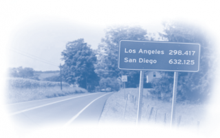
How far is it from San Diego to San Francisco? An estimate of 632.125 miles is precise—but not accurate. An estimate of somewhere between 400 and 500 miles is less precise but more accurate because the correct answer is 460 miles. Nevertheless, if you had no idea how far it is from San Diego to San Francisco, whom would you believe: someone who confidently says 632.125 miles, or someone who tentatively says somewhere between 400 and 500 miles? Probably the first, because precision implies certainty. Although reporting estimates with extreme precision indicates confidence in their accuracy, transportation engineers and urban planners often use precise numbers to report uncertain estimates. To illustrate this practice, I will draw on two manuals published by the Institute of Transportation Engineers (ITE)— Parking Generation and Trip Generation. These manuals have enormous practical consequences for transportation and land use. Urban planners rely on parking generation rates to establish off-street parking requirements, and transportation planners rely on trip generation rates to predict traffic effects of proposed developments. Many transportation models also incorporate trip generation rates. Yet a close look at the data shows that unwarranted trust in these precise but uncertain estimates of travel behavior can lead to bad transportation, parking, and land-use policies.

Download the PDF.

Transforming the Freight Industry: From Regulation to Competition to Decentralization in the Information Age

Amelia Regan

Thirty-five years ago, the common-carrier freight industry was backward and inefficient—the result of strict federal regulation that suppressed competition and innovation. Regulators determined rates, routes, entry of new firms, and even the kinds of goods firms could carry. In one Transforming famous instance, a trucking firm was licensed to carry frozen hush-puppies, nothing more, between two given cities in Louisiana, and was not permitted to carry anything on its return journeys.

Download the PDF.

2017-05-30T23:10:33+00:00Categories: ACCESS 20, Spring 2002|Tags: |

THE ACCESS ALMANAC: The Freeway-Congestion Paradox

Chao Chen and Pravin Varaiya

Traffic congestion on a freeway sets in once the density of vehicles exceeds a certain critical number. Above that, both vehicle speed and vehicle flow drop precipitously. Well-designed ramp meters can limit the number of vehicles entering a freeway, so that critical density is not reached, congestion is avoided and, paradoxically, both speed and flow increase. This double gain of reduced travel time and increased flow far exceeds any improvements that can be achieved by constructing more freeway lanes.

Download the PDF.