Going the Extra Mile: Intelligent Energy Management of Plug-In Hybrid Electric Vehicles

Kanok Boriboonsomsin, Guoyuan Wu, and Matthew Barth

Plug-in hybrid electric vehicles (PHEVs) have generated significant interest for their potential to decrease dependence on imported oil and to cut pollution and greenhouse gas emissions. While hybrid electric vehicles (HEVs) rely on their internal combustion engines to recharge their batteries, PHEVs generally have larger batteries and can be recharged by plugging into an outside electricity source, such as a standard home outlet (Figure 1). As a result, PHEVs are potentially more efficient and cleaner than HEVs, in part because more of their energy can come from clean, renewable sources.

Download the PDF.

Quantified Traveler: Travel Feedback Meets the Cloud to Change Behavior

Raja Sengupta and Joan L. Walker

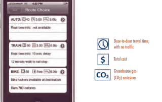
Halting climate change will require a concerted effort to reduce emissions from on-road vehicles. While significant progress has been made to improve vehicle efficiency and reduce CO2 emissions, surface transportation accounted for half the increase in US greenhouse gas (GHG) emissions over the past two decades. Today, surface transportation accounts for 24 percent of all US emissions. Automobile improvements alone will not be sufficient to meet federal and state emissions targets; policy makers also need to identify solutions that reduce the demand for car travel. Information technology offers a promising breakthrough on this front.

Download the PDF.

Phantom Trips

Adam Millard-Ball

Traffic lies at the heart of many fears about new urban development. In some cases, cities require developers to scale back housing or retail proposals to alleviate concerns about congestion. In other cases, cities widen roadways, add turn lanes, or lengthen signal cycles to accommodate projected traffic volumes. In both instances, planners and engineers wield considerable influence through their predictions of the number of vehicle trips that a proposed development will generate.

Download the PDF.

Trip Generation for Smart Growth Projects

Robert J. Schneider, Susan L. Handy, and Kevan Shafizadeh

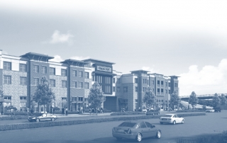
California encourages developers to pursue urban infill projects in order to achieve a variety of infrastructure efficiency and environmental goals. Since they are already surrounded by established developments, infill projects provide better opportunities for walking, bicycling, and public transit, and they encourage fewer automobile trips than new suburban developments. Nevertheless, developers often meet resistance when proposing infill projects.

Download the PDF.

Parking Reform Made Easy

Richard Willson

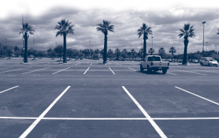
Parking requirements in zoning ordinances create one of the most wasteful elements of transportation and land use systems: unoccupied parking spaces. Each space requires over 300 square feet of valuable land or building area, yet many sit empty. Minimum parking requirements at shopping malls, for example, often lead to sprawling developments surrounded by large, underused parking lots. Spaces for workplaces may be well-used during the day but remain unoccupied in the evening because they are not shared with other land uses. Sometimes, the parking required is greater than the amount of parking ever used. Download the PDF.

Is a Half-Mile Circle the Right Standard for TODs?

Erick Guerra and Robert Cervero

Planners and researchers use transit catchment areas—the land around stations—as geographic units for predicting ridership, assessing the impacts of transit investments and, recently, for designing transit-oriented developments (TODs). In the US, a half-mile-radius circle has become the de facto standard for rail-transit catchment areas. Download the PDF.

What Density Doesn’t Tell Us About Sprawl

Eric Eidlin

Sprawl has no single definition. Many people, however, tend to think of "sprawling" cities as places where people make most of their trips by car, and non-sprawling cities as places where people are more likely to walk, cycle, or take transit. This is why Los Angeles, which has more vehicles per square mile than any other urbanized area, and where transit accounts for only two percent of the region's overall trips, is considered sprawling, while the New York urbanized area is not. We also know (or think we know) that places where people frequently walk, cycle, or take transit tend to have high population densities, and for this reason we tend to view low density as a proxy for sprawl. But as it turns out, the Los Angeles urbanized area—which in both myth and fact is very car-oriented—is also very dense. In fact, Los Angeles has been the densest urbanized area in the United States since the 1980s, denser even than New York and San Francisco.

Download the PDF.

Innovations In Traffic Modeling

Frank S. Koppelman

The study of travel behavior attempts to understand why, when, where, how, and with whom people travel. It then tries to predict how they will travel in the future. Predictions depend on the design and operation of future transportation systems and on changes in population characteristics. Thus, they are useful tools when choosing among alternative designs for future transportation services and sizing facilities to meet future demands.

Download the PDF.

Go to Top