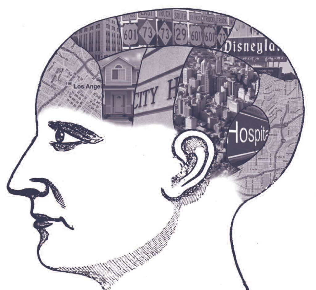
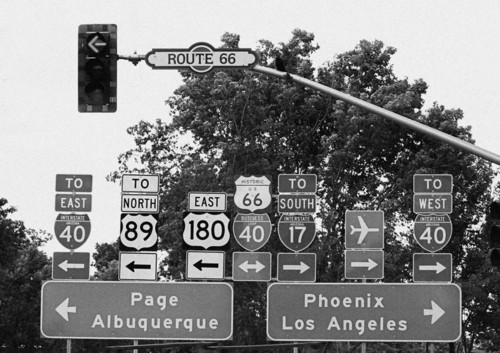
How do you get to work? Do you have a preferred route to your favorite restaurant? To the nearest hospital? To Disneyland? If you know—or think you know—the answers to any of these questions, then your cognitive map is at work. Humans rely on mental maps to store knowledge of places and routes in order to engage in travel and activities. People use their cognitive maps to decide where to go and how to get there. But accessibility research has largely ignored this essential aspect of travel behavior, despite the fact that a trip won’t happen without prior knowledge of a destination and potential routes to it. As cities become larger and more dispersed, good information about opportunities and travel systems is more important than ever.
Humans rely on mental maps to store knowledge of places and routes in order to engage in travel and activities. People use their cognitive maps to decide where to go and how to get there.
In our recent study, we found that cognitive maps and travel modes are linked in important ways that shape people’s access to the many opportunities cities afford. We surveyed a diverse group of people in South Los Angeles and found significant differences between those who engaged in cognitively-active modes of travel, such as walking or driving, and those who engaged in cognitively-passive modes of travel, such as being a passenger in a car or on public transit. Those who engaged in cognitively-active modes of travel more accurately described the location of common destinations than did those who typically traveled by less cognitively demanding modes. Our results highlight the importance of providing meaningful wayfinding information to all travelers, especially those who rely on others for mobility. Our findings also highlight the critical role physical movement plays in cognitive development, and how travel experiences over the long-term can contribute to a better understanding of cities and access to their diverse destinations.
What to Remember about Cognitive Maps
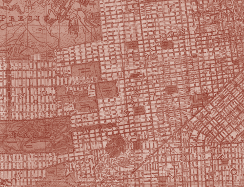
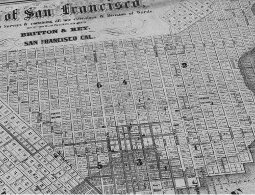
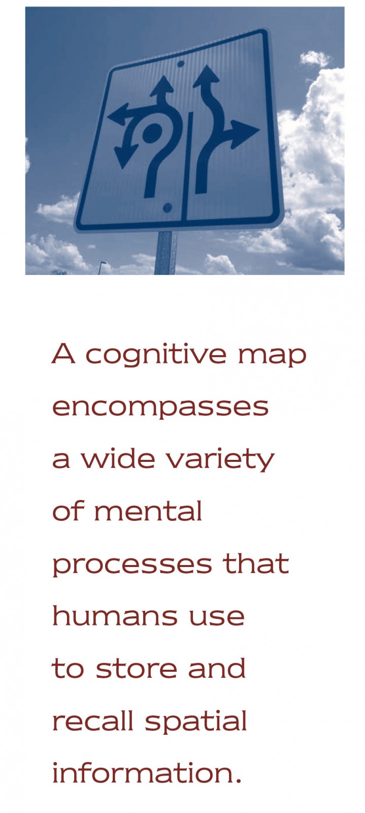
 Cognitive mapping research has long been a part of urban planning and design. Designer and planner Kevin Lynch introduced the concept in his 1960 book, Image of the City. Lynch showed that, as people interact with their surroundings, they interpret and encode them into mental maps. Lynch also established a typology of elements within a cognitive map that includes landmarks, routes, nodes, edges, and zones. This typology represents the city as an individual understands it. What psychologists call a cognitive map is not like the map one keeps in a glove compartment or views on a smartphone. Rather, it encompasses a wide variety of mental processes that humans use to store and recall spatial information. This, in turn, shapes how people live and travel.
Lynch and subsequent researchers showed that cognitive maps are imperfect representations of the built environment and contain distortions that influence behavior. In addition, errors in cognitive maps vary not just from person to person but among groups as well. In the 1980s, Tridib Banerjee and William Baer found that low-income minorities had much more constrained perceptions of their surroundings than higher-income white residents of the same city. Similarly in the 1990s, Anastasia Loukaitou-Sideris and Liette Gilbert showed that different ethnicities utilized different elements of the built environment to describe the same downtown Los Angeles neighborhood.
While planners and designers use cognitive maps to show differences in how individuals perceive places, research rarely addresses why those differences exist and what to do about them.
While planners and designers use cognitive maps to show differences in how individuals perceive places, research rarely addresses why those differences exist and what to do about them. Psychologists and geographers describe cognitive maps as the end result of spatial learning, a developmental process that depends on navigation and wayfinding. In other words, how we travel significantly affects what we know about our surroundings. While physical and digital maps, and word of mouth, help extend our cognitive maps, the act of traveling has traditionally been the primary means by which we learn about destinations and how to get to them. This learning process requires one to actively wayfind in order to accrue knowledge about the surrounding environment. Wayfinding is such a central developmental function that its effect can be observed in the brain. For example, neurobiologists have found that London cab drivers develop distinctively large hippocampi by spending so much time navigating the mazelike streets of London, at least in the era prior to GPS. Though such findings demonstrate the importance of wayfinding in cognitive development, our understanding of how everyday travel modes affect spatial learning is quite limited.
On Foot, Behind the Wheel, or in the Passenger Seat
 Given that travel experience plays such an important role in the spatial learning process, does traveling more by one mode, say by bus, shape a person’s cognitive map differently than someone who usually travels by other means, like driving? If so, how and to what extent do these travel experiences shape people’s knowledge of cities and accessibility? To test the hypothesis that different travel modes are associated with different types of knowledge about local and regional destinations, we surveyed two hundred individuals in South Los Angeles about how they usually travel and what they know about the location of and distance to key landmarks. We administered the survey in a shopping center near a transit station between Watts and Compton where residents are roughly half Latino and half African American. Respondents reported a wide range of modes for their daily travel, allowing us to compare spatial knowledge among modes such as driving, walking, and public transit.
Our initial results revealed a powerful pattern. For a wide range of spatial knowledge questions, responses were aligned by the level of wayfinding effort required of the traveler. Respondents who walked to the survey site exhibited spatial knowledge similar to auto drivers and less like auto passengers or transit users, despite the fact that walking and driving are dissimilar activities. Transit users were somewhat in between drivers and auto passengers on most questions, but more like passengers. For this research we defined travel modes based on the level of cognitively-active navigation required.
Here Be Dragons, and Job Opportunities
We observed significant spatial knowledge differences among cognitively-active and passive travelers, as well as for travelers who reported using a mix of active and passive modes [Table 1]. For example, when we asked respondents about the distance to Los Angeles City Hall, we expected they would have some idea, because it is readily accessible from our survey site by car and public transit. Absolute distance may be difficult to estimate if the respondent typically perceives travel in scales other than distance, such as in time or transfers (as transit users do). We therefore looked at other measures and controlled for a variety of factors known to influence travel, such as sex, ethnicity, employment status, and years spent living in the neighborhood. The absolute distance estimates showed an important result: cognitively-active travelers had significantly more accurate perceptions of distance than passive travelers. Mixed-mode travelers’ results lay in between those of the active and passive travelers.
We also asked respondents to indicate which of two possible destinations they thought was closer in distance to the survey location. The destination pairs we used encompassed a wide range of employment, civic, shopping, and recreational destinations across the Los Angeles region. Again, active and passive travelers were different, with active travelers more likely to pick the closer of the two. These results build on the findings of labor researchers, suggesting that many job seekers lack information when seeking opportunities across a region. Active transportation may help overcome such deficits.
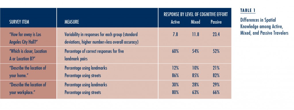
Finally, we looked at how spatial knowledge differences are embedded in the structure of the cognitive map. By asking respondents to describe their home and office or school locations in an open-ended way, we were able to capture the elements of the built environment that they found relevant to their everyday wayfinding and navigation. We compared cognitively-active and passive travelers by their relative reliance on landmarks, which past research has found to be the most rudimentary level of spatial knowledge. When asked to describe home locations, passive travelers were far more reliant on landmarks than active travelers, who were more likely to use streets and intersections. For work locations, active travelers had more success naming streets than passive travelers. Mixed-mode travelers’ responses tend to resemble active travelers’ in some instances and passive travelers’ in other instances.
When asked to describe home locations, passive travelers were far more reliant on landmarks than active travelers, who were more likely to use streets and intersections.
Implications, Short-Term and Long-Term
The ways that people travel affect their cognitive maps, resulting in significantly different knowledge of destinations and opportunities. The mental maps of cognitively-active travelers, like drivers and walkers, are similar, as are the maps of cognitively-passive travelers, who are generally car passengers and transit riders. Beyond being different, the maps of passive travelers are less accurate and more rudimentary than those of active travelers. Since our study, other scholars have found similar results elsewhere in the world. For example, in the Netherlands, transportation researchers found that college students who walked and biked had better knowledge of their campus and town than those who relied on public transportation.
Differences in cognitive maps have important implications for accessibility, transportation planning, and public policy. Sparse and inaccurate information about one’s city is likely to reduce activity and travel in the empty spaces of the mental map. In reality, those empty spaces may be filled with jobs, services, or recreation opportunities. Even if passive travelling allows one to do other things, like texting a friend or relaxing, those with incomplete mental maps lose out on the opportunities from a more complete cognitive map. All else being equal, regular transit users and those who rely on others for mobility have more empty spaces in their mental maps than do drivers and walkers.
All else being equal, regular transit users and those who rely on others for mobility have more empty spaces in their mental maps than do drivers and walkers.
Our findings for Los Angeles do not diminish the importance of public transit. In transit-rich cities, it may be that transit and walking reveal more potential activities, while drivers miss out. For all cities, however, these findings suggest that providing compensatory information for passive travelers may be critical to building their mental maps. Opportunity and wayfinding information can be provided to transit users in multiple formats to reach a diverse populace with different levels of spatial understanding. In some ways, new information and communication technologies create unprecedented opportunities to provide better information about transit systems the cities they traverse. However, transit agencies and others focused on broad-based mobility need to be sure that these technologies are themselves accessible and provide relevant information to the entire urban population, not just to technophiles or transit veterans.
Our findings suggest that researchers and transportation planners need to make a greater effort to understand how transportation systems bring individuals into physical and cognitive contact with the city and its destinations. We looked at cognitive maps at a single point in time, but developing the knowledge and skills to engage with one’s surroundings is a lifelong process. Does reliance on passive travel begin in childhood? Are children chauffeured to school today less spatially knowledgeable than their parents who rode bicycles to school? Can people learn to become better explorers, engaging more with their cities and the opportunities within them? Many of these questions underlie planners’ concerns regarding livability and well-being, but so far we do not have theories and evidence to direct us to an optimum mobility system. Developing a better cognitive map may be one reason to encourage active travel and exploration, not just by car but by foot and bicycle as well.
Can people learn to become better explorers, engaging more with their cities and the opportunities within them?
A potential short-term solution for information deficits lies with technology, but we must also ask what effects technology might have in the long term on cognitive maps and spatial knowledge. Will information so easily acquired persist in the cognitive map? What if the digital information is wrong, incomplete, or biased? There may be tradeoffs between short-term benefits of smartphone navigation and long-term deficits of spatial knowledge. Regardless, cognitive mapping and spatial knowledge have been missing from our analyses of travel behavior and from transportation planning for accessibility. Cognitive mapping methods and concepts have evolved significantly since Lynch’s study. They can help shed light not just on differences among travel modes, but also on a wide range of transportation issues that encompass what a person knows about destinations, routes, and the surrounding city.
This article is adapted from “Accessibility and Cognition: The Effect of Transport Mode on Spatial Knowledge,” originally published in Urban Studies.
Further Readings
Tridib Banerjee and William. C. Baer. 1984. Beyond the Neighborhood Unit: Residential Environments and Public Policy, New York: Plenum Press.
Reginald G. Golledge and Tommy Gärling. 2004. “Cognitive Maps and Urban Travel,” Handbook of Transport Geography and Spatial Systems, Edited by David A. Hensher, Kenneth J. Button, Kingsley E. Haynes and P. R. Stopher, Amsterdam: Elsevier.
Kevin Lynch. 1960. The Image of the City, Cambridge, MA: Technology Press.
Andrew Mondschein. 2013. “Walk Further: Information and Communication Technologies and the Cognitive Walking Experience,” Walking and the Life of the City, Edited by Mitchell Moss and Andrew Mondschein, New York: NYU Rudin Center for Transportation Policy and Management, Forthcoming.
Andrew Mondschein, Evelyn Blumenberg, and Brian. D. Taylor. 2010. “Accessibility and Cognition: The Effect of Transport Mode on Spatial Knowledge,” Urban Studies, 47(4): 845–866.
Andrew Mondschein, Evelyn Blumenberg, and Brian. D. Taylor. 2007. “Cognitive Mapping, Travel Behavior, and Access to Opportunity,” Journal of the Transportation Research Board, 1985: 266–272.