[sharelines]A brief history of America’s love affair with the #freeway, and why many cities have moved on. #TODs
Few planning decisions have affected American cities as much as those involving urban freeways. Massive freeway infrastructure projects have reconfigured urban form, supplanted neighborhoods, displaced tens of thousands of people, and cost billions of dollars. Congress and state legislatures passed important new laws that guided where freeways could be built, what funds were available, which types of consultation and analysis should be conducted, and what impacts were permissible. Lawmakers and courts required that projects be planned and completed with maximum sensitivity to the environment, with concern for relocating displaced residents, and with active citizen participation.
This article is based on the book, Changing Lanes, published by the MIT Press in 2013. Both the book and the article tell the story of those freeways, recounting America’s original love affair with them and the controversies that emerged during their construction in dense urban areas.
The professionals involved in this story include highway engineers in the leading role, as well as urban planners, landscape architects, and architects. Here we review the evolution of freeway design as professionals responded to significant social changes in the United States. We then examine changes in the regulatory environment of freeway construction. Finally, we focus on urban freeway controversies and give special attention to three famous cases—Los Angeles, Memphis, and Syracuse—each with very different histories and outcomes.
Origins of Urban Freeway Development
Professionals and politicians viewed urban freeways from different angles and tried to shift freeway policies to match their own priorities. As a result of the varying perspectives, urban freeways filled divergent roles: traffic conduits, tools of economic redevelopment and social policy, and components of national defense.
Some urban planners warned that no amount of freeway building would ever solve the urban traffic problem. These voices, however, were drowned by massive federal subsidies for freeway
construction.
Highway engineers led the process of urban freeway construction, displaying great confidence in their ability to assess traffic demand, analyze alternatives, and construct elaborate infrastructure. City planners developed a more complex understanding of freeways with a focus on long-term guidance of urban physical change, but played a subordinate role in the process. Landscape architects pioneered parkway design during the 1920s and 1930s, but became peripheral actors when freeways were scaled-up to handle massive urban traffic loads. Architects generated many imaginative designs for urban freeways, but were only brought in for consultation during the freeway controversies of the 1960s.
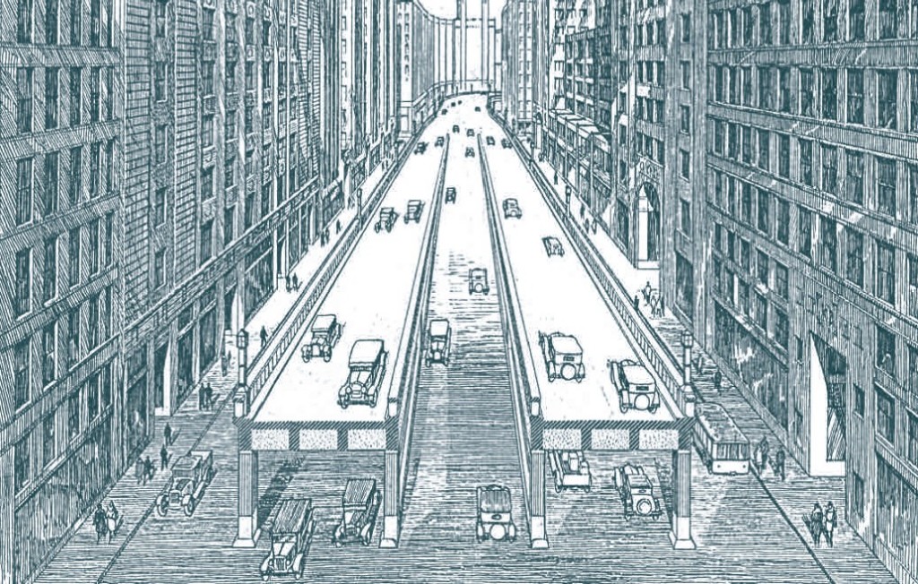
Between 1939 and 1945, the nation moved from economic depression to war. A vision of the rational, modernized city replaced the 1930s view of urban parkways compatible with existing urban design. The newly imagined modern city radiated only positive symbolisms: elevation, clarity, hygiene, speed, rational order, and the beneficent use of state power. In contrast, the old city was cloaked in negative images of disorder and decay.
As production shifted to war goods after 1941, highway construction was curtailed. During this lull, however, state and federal officials forged the freeway plans that would shape postwar America. Diverse strands of thought about urban freeways were united into two key federal documents: Toll Roads and Free Roads (1939) and Interregional Highways (1944). In these documents, highway engineers and city planners endorsed “radial-concentric” freeway patterns. These patterns entailed new urban freeways that would penetrate the urban core and be used to clear out slums and blighted areas. Inner beltways were envisioned around renewed central business districts. Alongside these visions of urban freeways, the Federal-Aid Highway Act of 1944 gave the federal government and the state highway departments additional power to shape urban freeway patterns in postwar America.
Some urban planners warned that no amount of freeway building would ever solve the urban traffic problem. These voices, however, were drowned by massive federal subsidies for freeway construction. The passage of the Interstate and Defense Highway Act of 1956, which provided states with a 90 percent federal match for all construction costs, removed all fiscal obstacles to metropolitan freeways. The urban freeway program would now be fueled with billions of federal dollars, an irresistible force pushing old doubts and questions aside. Urban freeway designs that were developed during the previous three decades became the blueprints for actual construction from 1956 to 1970. State highway engineers, with the support of local growth coalitions, pushed radial freeways and inner beltways through old neighborhoods and industrial districts, linking central business districts with emerging regional highway networks.
Urban renewal seemed to promise revitalization through clearing decayed central slum districts. Planners and other growth coalition members saw transportation improvements as a critical element of central city revitalization. New highways would allow middle- and upper-class white-collar workers and shoppers to speed in and out of central business districts.
By the late 1960s, however, citizen protests over redevelopment and political stalemates over controversial freeways forced public officials to reassess the complex effects of large-scale infrastructure projects. The blind acceptance of urban freeways as emblems of growth and prosperity gradually began to wane. Freeway protests grew louder, and pressures for reform led to a wave of legislation curbing the construction of new freeways.
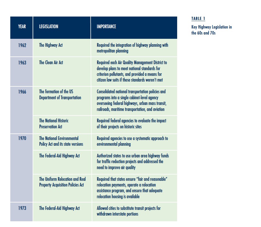
The evolution in urban highway planning was both reflected in and fostered by changes in the regulatory framework in which planning decisions were made. Environmental legislation in the late 1960s and early 1970s armed citizens and local governments with legal tools to challenge unpopular freeway segments. These pieces of legislation had teeth and, by providing opponents with a basis for litigation, they pushed the balance of power in freeway controversies toward citizens and local governments. Table 1 lists some of the key pieces of legislation.
Urban Freeways: Impacts and Controversies
Occurring in dozens of cities, freeway controversies revolved around a wide range of topics: aesthetics, commercial interests, transportation system efficiency, environmental protection, historic preservation, and race concerns.
Syracuse, Memphis, and Los Angeles provide a temporal cross-section of the freeway revolts. Syracuse embraced urban freeways early on but paid a steep price in quality of life. The city is now involved in very tense decision making about whether to demolish sections of freeways within its central business district. Meanwhile, Interstate 40 in Memphis was stopped in its tracks, and the Century Freeway in Los Angeles was heavily modified from its original plan.
Syracuse: “The Best Thing since the Erie Canal!”
Interstates 81 and 690, which now traverse the heart of Syracuse, were first conceived in the 1940s. In 1944, the Syracuse-Onondaga County Post-War Planning Council envisioned a modern highway network for the city. The plan aimed to decrease congestion and traffic accidents and, in doing so, help maintain the city’s economic vitality.
There was little controversy about whether the urban freeway plan should go forward. All Syracuse mayors and most planners, businesses, industries, and major local employers supported the plan. There was a bit more controversy over design, but even that was relatively muted, and some of it didn’t occur until after construction.
By the mid-1960s, overhead interstate highways running north-south and east-west divided the center of Syracuse. They displaced and dispersed Italian-American, Jewish-American, African-American, and other ethnic neighborhoods. The city’s subsequent decline cannot be attributed only to choices about urban freeways, but these decisions reinforced the effects of industrial relocation and of economically and racially motivated suburbanization.
Memphis: Interstate 40 Deflected around Overton Park
I-40 begins in Barstow, California. Coursing eastward and partially following old Route 66, it connects cities from Flagstaff, Arizona, to Durham, North Carolina. By the mid-1960s, it was mostly complete except for a few short sections. One of these sections was a four-mile stretch in the central part of Memphis that includes Overton Park, a large, publicly owned park located within an affluent, predominantly white residential area.
Memphis officials began to consider a highway in and around Overton Park in 1953. In 1955, the planning firm Harland Bartholomew and Associates was employed to study interstate highway routes. Memphis and Shelby County adopted the basic transportation system plan that resulted from this study. In the plan, the east-west interstate was routed through Overton Park.
In 1956, the Bureau of Public Roads approved the corridor alignment of I-40 through the park. Controversy arose almost immediately. Opponents were initially disorganized but, between 1961 and 1964, opposition became unified and coordinated. It resulted in the landmark US Supreme Court case, Citizens to Preserve Overton Park v. Volpe, which saved the park and helped establish the current framework for court review of transportation agency decisions.
Los Angeles: The Freeway with a Heart
In 1959, the California legislature created the California Freeway and Expressway System, authorizing a grid-like network of freeways overlaying the entire Los Angeles basin. This network included a segment known as the Century Freeway, a standard ten-lane highway. More than twenty interchanges were planned to service local arterials in the ten jurisdictions the freeway traversed. Construction was to begin in 1972, and the freeway was scheduled to open in 1977. But building the $500 million project would displace an estimated 21,000 people living in the freeway right-of-way.
Almost from its inception, the Century Freeway was controversial. As land acquisition and freeway design progressed, opponents organized. By 1972, however, more than 35 percent of the needed parcels had been acquired, and another 35 percent had been cleared. About 11,000 homes and apartments were taken.
In February 1972, one month prior to the planned start of construction, a newly created public interest law firm, the Center for Law in the Public Interest, filed a federal lawsuit on behalf of four couples living within the proposed freeway right-of-way. Several national civil rights and environmental activist organizations were also parties to the suit, including the NAACP, the Sierra Club, and the Environmental Defense Fund. Even the City of Hawthorne joined the suit which sought to prevent the state from acquiring property until Environmental Impact Statements were approved. The suit also alleged inadequate relocation assistance, denial of equal protection to minorities and poor residents in the corridor, inadequate public hearings, and violation of due process.
In July 1972, federal district court judge Harry Pregerson ordered the state to stop work on the Century Freeway. The preliminary injunction called for preparation of a formal Environmental Impact Statement, additional hearings focusing on noise and air pollution concerns, further studies on the availability of replacement housing for those displaced by the project, and specific assurance by the state that it could provide relocation assistance and payments to those displaced by the freeway’s construction. The decision was upheld on appeal. Work on the Century Freeway would be halted for the next nine years.
Only in 1993, following the requirements of a landmark consent decree, did the “freeway with a heart,” “the intelligent freeway,” and “the most costly freeway ever built” finally open. It was built with heavy landscaping, HOV lanes, extensive housing made available to the displaced residents, and metered transition ramps. Plans for newly mandated transit, now the Green Line light rail, were later realized. From inception to completion, the project spanned more than 30 years—nearly triple the time normally required to construct a freeway.
Conclusion
Jane Jacobs argued that cities are a problem of “organized complexity.” If that’s true, then their evolution must be guided by ideas in proportion with that complexity. In the middle of the twentieth century, the construction of a new generation of high-capacity roads for American cities should have been guided by a strong and well-developed understanding of how cities work. Transportation planners, land use planners, environmental planners, and urban designers should have worked together in an equal partnership. Planning for roads and public transit should also have been integrated into a single process. Unfortunately, this did not happen. Instead, a narrow mode of highway planning was used instead of multimodal transportation planning, and we have been struggling with the consequences even since. Instead of producing the gleaming, healthy, modernized cities portrayed in the utopias of the 1930s, auto-centric freeways produced a polarized urban landscape, troubled inner cities, and fragmented sprawl.
A narrow mode of highway planning was used instead of multimodal transportation planning, and we have been struggling with the consequences even since.
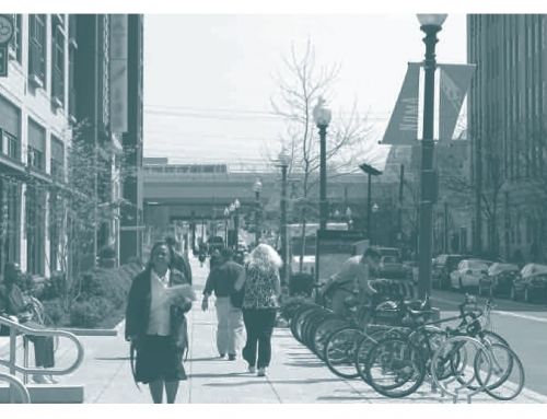
In the last few years, however, many cities across the nation have proposed, approved, and begun demolishing urban highways, replacing them with housing, parks, bicycle paths, commercial buildings, and traditional city streets. One reason is that many highways constructed during the postwar era are approaching the end of their useful lives (approximately 40 years). But another reason is that there is an increasing perception that urban centers provide creative development potential. Hopefully, the future will see greater modal balance with transit, walking, and cycling integrated into mixed-use, environmentally sustainable regions.
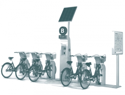
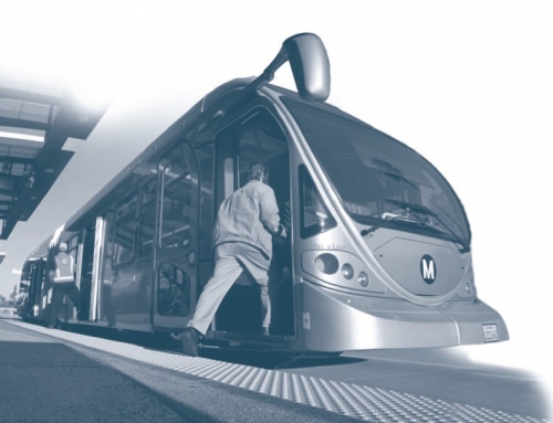
Although not a panacea for our transportation problems, transit-oriented development does provide an alternative to more freeway building within metropolitan areas. In contrast to freeway systems, transit systems do not destroy the urban fabric since they can be placed on narrow rights-of-way, located underground, or operated on existing streets (as with streetcars, trolleys, and buses). Furthermore, transit systems can be integrated with well-designed, walkable city streets. It’s time for a new direction that places less emphasis on new infrastructure for the motor vehicle and more emphasis on multimodal transportation as we design our urban fabric for high accessibility.
This article is a brief summation of the book, Changing Lanes, published by the MIT Press in 2013.
Further Readings
David J. St. Clair. 1986. The Motorization of American Cities, New York: Praeger.