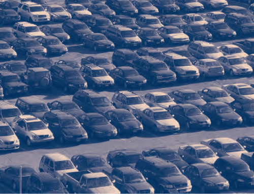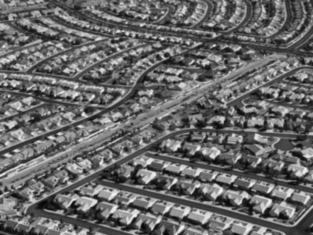
During the last half of the 20th century, cities and towns across America were built primarily for one transportation mode: the automobile. Much of this development occurred on the urban periphery, creating the suburbs that are now home to more Americans than either traditional central cities or small towns. Today, while federal transportation policies and urban planners have shifted toward promoting a more multimodal form of development, the legacy of the postwar era remains: thousands of suburban neighborhoods poorly served by any mode of transportation other than the automobile.
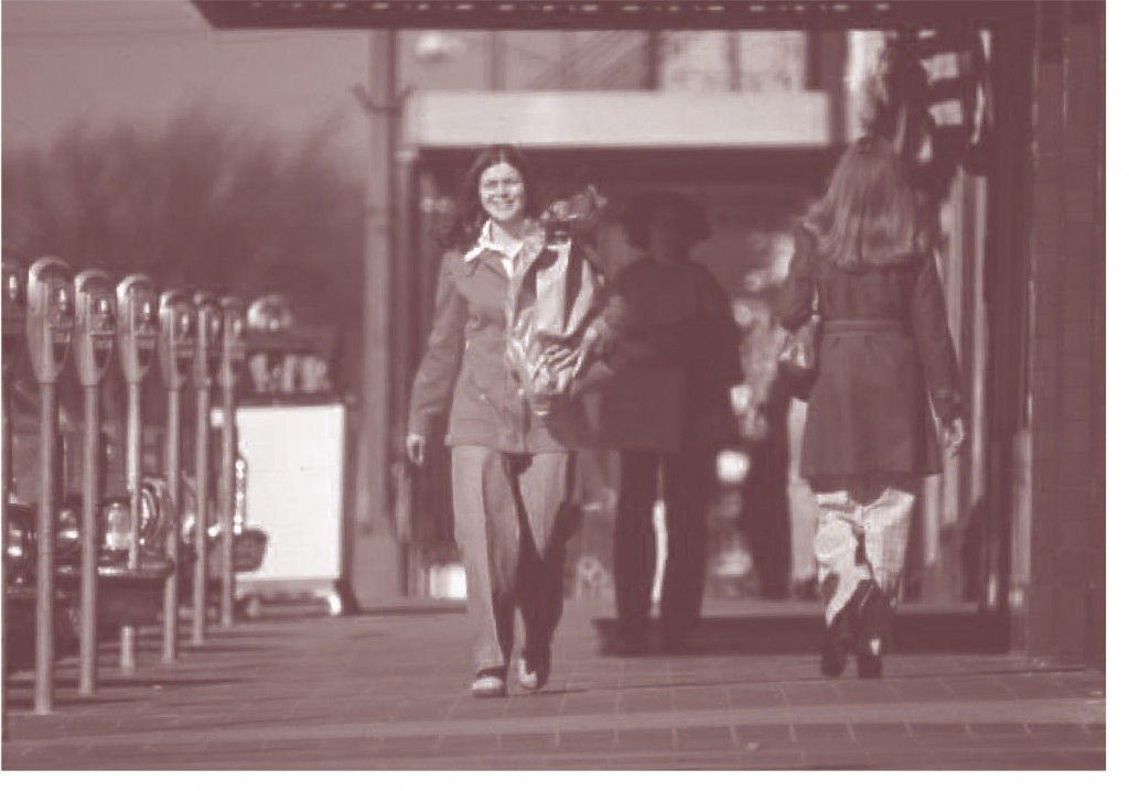
Researchers have spilled much ink debating the feasibility of alternatives to car travel, but have focused less on how suburbs built for the car might be transformed to accommodate other modes. Seven years ago, communities in the South Bay area of Los Angeles County decided to focus on this question. They found that walking is the gateway mode for alternative transportation. The 2009 National Household Travel Survey shows that 10 percent of all trips in the US are taken on foot. Relatedly, an American Public Transportation Association analysis of over 150 on-board transit surveys from 2000 to 2005 showed that walking is the access mode for about 60 percent of all transit trips.
Walking travel and land use patterns vary substantially within the South Bay. Analyzing the correlates of walking in that area provides insight into ways to retrofit auto-oriented suburbs for more pedestrian travel.
The California Context
The opportunities for retrofitting suburbs to increase transit use and walking are especially golden in the Golden State. While the proliferation of auto-oriented suburbs has continued largely unabated in sprawling metropolitan areas such as Atlanta, Houston, and Phoenix, in California there are several reasons why suburbs will be retrofitting to increase walking. The first is geography: the major coastal metro areas (Los Angeles, San Diego, and San Francisco) are hemmed in by mountain ranges or desert, with little room for new development. While population density has declined in most US cities for over a century, Western cities, including greater Los Angeles, saw densities increase in recent decades. The second reason is economics: the collapse of the recent housing bubble dampened the market for new single-family residential units, particularly on the exurban fringe of California’s metropolitan areas. The past few years have seen marked shifts in building from inland to coastal counties and from single-family to multi-family units. The state’s planning and policy context is the third, and perhaps most important, reason why suburbs will be retrofitted to increase walking. The place that popularized car culture is now at the forefront of linking transportation planning, land use policy, and climate change concerns. California Senate Bill 375, passed in 2008, requires metropolitan planning organizations (MPOs) to develop “sustainable communities strategies” including infill development.
The place that popularized car culture is now at the forefront of linking transportation planning, land use policy, and climate change concerns.
This combination of geography, market forces, and public policy will limit the expansion of California’s urban areas, providing consistent pressure for infill development in the coastal counties. Adding more people to already congested places such as San Diego, the San Francisco Bay Area, and Los Angeles will increase the political pressure to reduce the resulting car traffic on arterial streets. Communities will look for relief valves—ways to move some of the traffic from infill development to alternate modes of travel. This context prompted the South Bay Cities Council of Governments to study how to accommodate growth in an area built for the car a half century ago.
The South Bay Study
The South Bay area of Los Angeles County is a sociodemographically diverse collection of 16 cities between Los Angeles International Airport and Long Beach. Home to about a million people, these communities experienced their most rapid growth in the three decades after World War II. Car culture dominates in the South Bay, which has an arterial street grid dotted by strip malls and car-oriented developments. While the South Bay is built out and has almost no vacant land, the area is projected to add over 170,000 people between 2000 and 2025, providing substantial pressure for infill development.
Infill development in built-out suburban communities is often a hot-button issue. Residents worry about traffic impacts, and not without cause. A lack of open land means few opportunities to widen streets, and the growth projected for the South Bay raises the possibility that roadways will congest further. California communities often have relatively high but uniform densities that provide few opportunities to concentrate trip origins and destinations to facilitate transit. This poses real obstacles to increasing population density without increasing traffic congestion. A traffic relief valve of some sort would be handy. How can South Bay communities grow without translating all of that growth into car travel? Can some trips be diverted to alternative modes? What role can walkingplay?
How can South Bay communities grow without translating all of that growth into car travel?
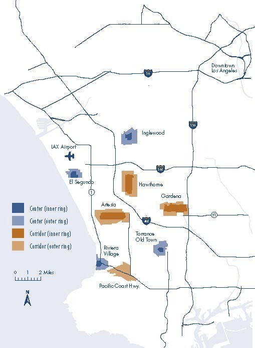
To answer those questions, we studied travel patterns in eight neighborhoods in the South Bay. The neighborhoods were of two types: pedestrian-oriented centers and auto-oriented corridors. Centers have an inwardly focused street geometry with a commercial core in the middle, while corridors have a linear commercial core along a major arterial street, with residential areas surrounding the commercial strip. While both center and corridor neighborhoods have residential and commercial uses in close proximity to each other, the center neighborhoods reflect older pedestrian- and transit-oriented street geometries that are characteristic of pre-WWII neighborhoods, as opposed to corridor neighborhoods that were built primarily in the automobile era. To understand the variation in walking travel within neighborhoods, we further divided these neighborhoods into inner and outer rings—roughly quarter-mile and half-mile buffers radiating from the neighborhood center or corridor, corresponding to census block group boundaries (Figure 1 shows the study areas).
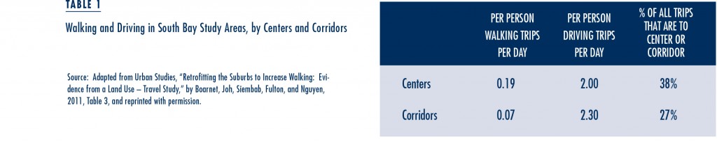
Our primary source of travel behavior data was the South Bay Travel Survey. Participants in the survey completed a one-day travel diary that included questions about trip purpose, mode choice, and trip distance. We compared differences in travel behavior by mode (walking versus driving) across the eight center and corridor neighborhoods. People who live in the centered neighborhoods consistently walk more, and the centers capture a higher share of the center-based respondents’ total trips. Table 1 shows the differences, which persisted in regression analyses that controlled for individual and household sociodemographic characteristics. The data also show that people living in the centered neighborhoods generally take shorter trips, and those shorter trips are more likely to be by walking. For some specific purposes (e.g., grocery shopping, other personal shopping, and entertainment) center residents take more trips than people living in corridors, presumably in part because shorter trip distances can encourage people to travel more.
But why do people who live in centers walk more? To explore this, we regressed the number of walking and driving trips per person on individual and household characteristics and land use variables. These included population density, attributes of the street network including grid-orientedness and block size, and measures of local business activity (the number of commercial establishments per acre, employees per acre, sales per acre, and the ratio of businesses in the inner ring divided by the outer ring).
Our results show that the number of businesses per acre is the single most robust indicator of whether people are likely to walk in their neighborhood. We find that people living in neighborhoods with more business establishments per acre conduct more of their travel within their neighborhood and are more likely to travel by walking.
This suggests that walkable neighborhoods are often places where there are many nearby destinations. Measures that might correlate with large establishments—retail employment or sales—did not predict walking travel nearly as reliably as the number of businesses per acre, suggesting that the key is not simply sales but a large number and variety of businesses in a relatively small area.
But is the association between businesses per acre and walking causal? Could it be that business density does not cause walking but that there is a self-selection phenomenon where people who like to walk choose to live near a higher concentration of retail and service destinations?
We addressed this issue by studying variations in travel behavior within one small study area: the Artesia Boulevard corridor. The Artesia corridor is a mile-long commercial strip demarcated by intersections with major arterial streets at each endpoint and intersected by a smaller arterial street roughly at the corridor midpoint. We selected Artesia because businesses are not distributed smoothly along the commercial corridor but are concentrated in the middle. We compared walking trips for survey respondents living within a quarter mile of either corridor endpoint with walking trips for people living within a quarter mile of the middle intersection. If residential location choice largely determines the study area where people live but not where along the corridor residents live, travel behavior differences within the Artesia corridor can be attributed to direct effects of differences in the built environment and business concentration, and not residential preferences.
Our results show that, compared to other residents in the corridor, people living near the midpoint of the Artesia corridor take more walking trips and fewer driving trips, take a larger fraction of their total trips within the corridor, and are more likely to walk when traveling to the businesses along Artesia Boulevard. The differences are statistically significant and striking in magnitude. Survey respondents living within a quarter-mile of the midpoint took five times as many daily walking trips and 30 percent fewer driving trips than others in the corridor.
Pedestrian-oriented centers require a concentration of business activity larger than the local residents can support.
Looking further, we compared actual retail sales with estimates of local retail demand for both the resident and employee populations of the area to assess whether walkable neighborhoods have commercial concentrations that serve the local population or whether those neighborhoods must also import customers from other places. We find that retail sales in the two centers with the most walking are approximately three to four times as large as what could be supported by the residents and employees in those centers, suggesting that pedestrian-oriented centers require a concentration of business activity larger than the local residents can support. Thus people must drive from outside of the neighborhood to support the commercial activity that in turn encourages local residents to walk more. Therefore, business densities that reduce driving within the neighborhood also require some driving from outside of the neighborhood, implying that policy must focus not just on small and dense village centers but on knitting these together in larger transportation networks.
Policy Recommendations and Conclusion
 While traditional urban design elements such as inwardly focused street geometry may encourage walking, our results suggest that a more critical factor is the concentration of business activity in a compact commercial center. The tricky part is that the business concentration needed to encourage walking appears to be larger than most neighborhood residential populations can support. Given that, suburban regions should focus both on fostering pedestrian centers and on knitting those centers together with transportation networks, though such networks need not accommodate only cars.
We suggest both a land use approach and a mobility approach, and coordination between the two. A land use approach would focus on identifying and promoting walkable centers. Even auto-oriented areas such as the Artesia corridor can enjoy concentrations of pedestrian activity if there are retail businesses nearby. Planners can develop pedestrian-oriented centers through densification and infill development, for example by offering density bonuses. Planners might reduce or remove minimum parking requirements or even limit parking.
A mobility approach would promote transit service, tailored to the context of the suburbs. Rather than the common approach of running underutilized central-city style buses, in a region like the South Bay transit might include high-frequency shuttle bus service between neighborhood centers. A more ambitious but possibly more appropriate approach would promote the use of small, fuel-efficient vehicles (such as neighborhood electric cars) and through carshare programs. The South Bay Cities Council of Governments is already experimenting with a neighborhood electric vehicle demonstration program. The advantage of neighborhood vehicles is that they are small, allowing more efficient use of limited streets and parking with a lighter environmental footprint. While neighborhood electric vehicles are not designed for travel speeds over 25 miles per hour, they may be ideal for relatively dense, auto-oriented suburbs like the South Bay, where an overwhelming number of local non-work trips are shorter than three miles.
The advantage of neighborhood vehicles is that they are small, allowing more efficient use of limited streets and parking with a lighter environmental footprint.
Overall, the first step would be to develop walkable nodes of neighborhood businesses that would then be connected through regional mobility networks. Implementing such a strategy is a political and planning challenge but, as the regulatory and market pressures now seen in California become more prevalent throughout the US, we believe that the policies that support suburban walking will become more common. Adapting auto-oriented suburbs to promote alternative travel modes will be increasingly central to the realities of transportation planning in the future, and it all starts by focusing on the walk from home to the store.
Further Readings
Marlon G. Boarnet, Kenneth Joh, Walter Siembab, William Fulton, and Mai Thi Nguyen. 2011. “Retrofitting the Suburbs to Increase Walking: Evidence from a Land-Use-Travel Study,” Urban Studies, 48(1): 129–159.
Marlon G. Boarnet. 2011. “Longer View: A Broader Context for Land Use and Travel Behavior, and a Research Agenda,” Journal of the American Planning Association, 77(3): 197–213.
Susan L. Handy and Kelly J. Clifton. 2001. “Local Shopping as a Strategy for Reducing Automobile Travel,” Transportation, 28(4): 317–346.